Costa Vicentina Beyond Sagres: Portugal's Wildest Coast
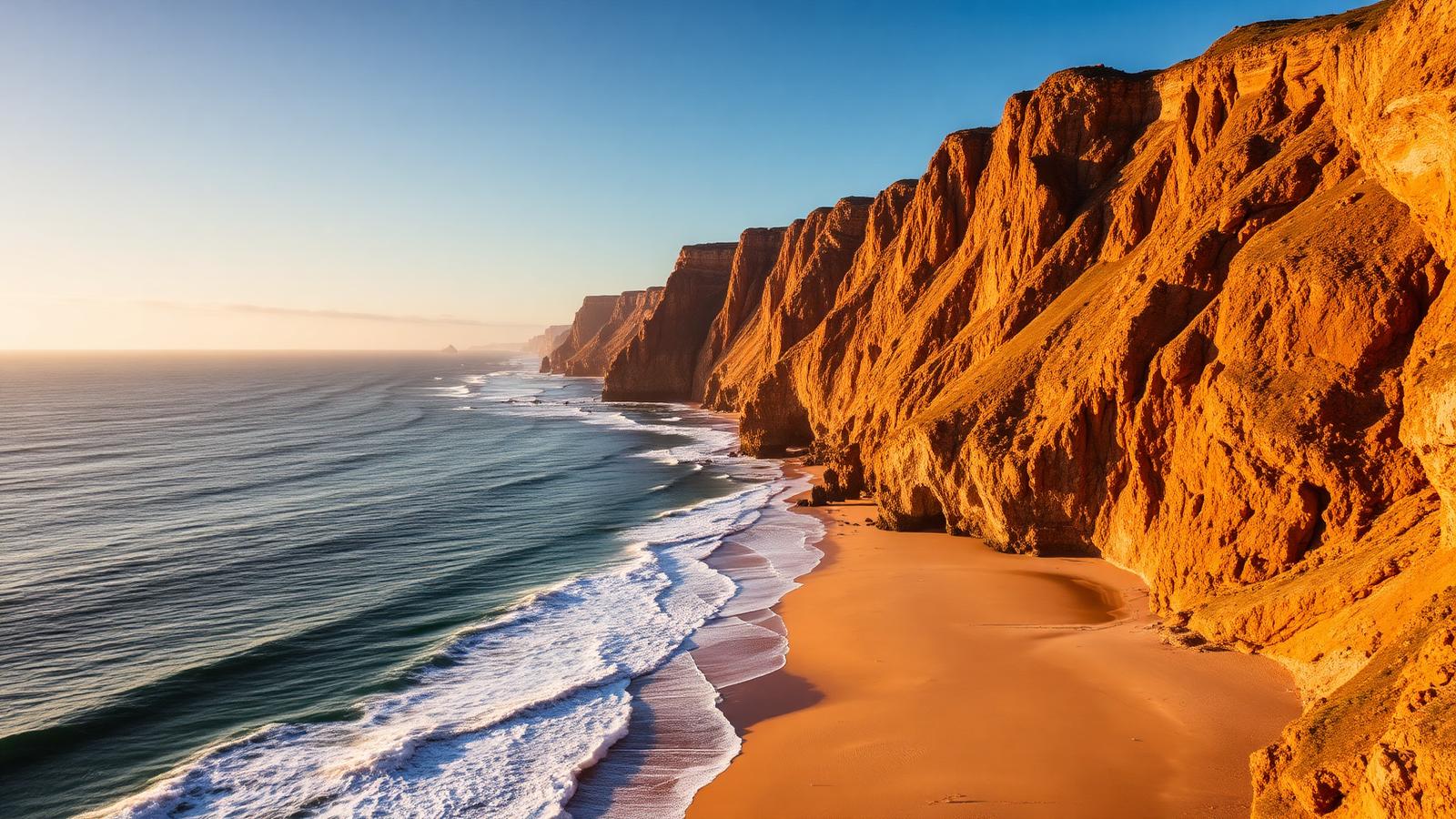
TL;DR
The Costa Vicentina is the stretch of Atlantic coast that runs north from Sagres along the western edge of the Algarve and into the Alentejo. It sits inside the Parque Natural do Sudoeste Alentejano e Costa Vicentina, classified as a protected landscape in 1988 and elevated to natural park status by Decreto Regulamentar 26/95 of 21 September 1995. According to ICNF, the park covers 89,568 hectares (about 60,577 ha terrestrial and 28,992 ha marine) across the municipalities of Vila do Bispo, Aljezur, Odemira, and Sines, and its construction restrictions explain the most visible feature of the coast — the absence of resort development. Five beaches define the visitor experience: Castelejo and Cordoama in Vila do Bispo, and Bordeira, Amado, and Arrifana in Aljezur. The Rota Vicentina links them with two long-distance footpaths — the Fishermen's Trail (226.5 km along the cliffs, 13 stages between Porto Covo and Lagos) and the Historical Way (inland, Santiago do Cacém to Odeceixe). From Lagos the drive to Castelejo is about 45 minutes; the Vamus 47 bus reaches Vila do Bispo and Sagres but does not serve the Costa Vicentina beaches directly — a car or pre-booked taxi is required beyond that point.
Key Takeaways
- •The Parque Natural do Sudoeste Alentejano e Costa Vicentina was first classified as a protected landscape in 1988 and elevated to natural park status by Decreto Regulamentar 26/95 of 21 September 1995. According to ICNF, it covers 89,568 hectares (about 60,577 ha terrestrial and 28,992 ha marine) across the municipalities of Sines, Odemira, Aljezur, and Vila do Bispo, with strict construction restrictions that have kept the coast almost free of development.
- •The Costa Vicentina is not an extension of the Algarve resort coast — it is a stretch with its own logic. The towns of Aljezur, Carrapateira, and Vila do Bispo run on local economies (fishing, agriculture, small-scale surf tourism) rather than mass tourism, and the absence of resort infrastructure is a deliberate result of conservation policy, not a temporary state.
- •Five beaches define the visitor experience: Castelejo and Cordoama in Vila do Bispo (linked by sand at low tide, dark schist cliffs); Bordeira in Aljezur (one of the longest beaches in Portugal, more than two kilometres of dune-backed sand); Amado (one of Portugal's best-known surf beaches); and Arrifana (a sheltered cove that produces consistent, beginner-friendly waves).
- •The Rota Vicentina is a network of two long-distance footpaths: the Fishermen's Trail (Trilho dos Pescadores), 226.5 kilometres along the cliffs in 13 stages between Porto Covo and Lagos; and the Historical Way (Caminho Histórico), inland between Santiago do Cacém and Odeceixe. The recommended walking window is September to June; check the official Rota Vicentina pages for current stage distances.
- •From Lagos, Castelejo is about 45 minutes by car via the EN125 and N268 (Alvor adds another 15 minutes); for the northern beaches (Amado, Arrifana, Aljezur) take the N120 directly. Public transport thins out fast: the Vamus 47 bus runs Lagos–Sagres via Vila do Bispo on a published timetable that varies by day, but it does not serve the Costa Vicentina beaches — a car or pre-booked taxi is required beyond Vila do Bispo.
- •The best months to visit are March to June and September to October. August is hot, windy (the Nortada blows steadily from the north), and crowded with surf tourism; November to February brings short days and rain. The Atlantic stays cold year-round — sea temperatures rarely exceed 19 °C even in late summer.
Where the Algarve You Know Ends
The exact stretch where one coast becomes another
Drive west from Lagos for forty minutes on the EN125 and you arrive in Vila do Bispo. Most visitors continue south for another fifteen minutes to Sagres, take their photo at the Fortaleza, and turn back. The road most visitors miss branches the other way. From the roundabout in the centre of Vila do Bispo, the N268 heads north along the coast — and within five minutes the landscape that defines the Algarve in most travel writing simply stops being there.
The pale limestone cliffs become dark schist. The pine and almond inland gives way to scrub and heath. The villas thin out, then disappear. Construction signs are absent because there is nothing to build. By the time you reach the turn-off for Praia do Castelejo, perhaps ten minutes north of Vila do Bispo, the change is unmistakable — different geology, different microclimate, different economy. The legal park boundary is set elsewhere by decree, but for most visitors this is where the Costa Vicentina starts to feel like itself.
The point of this guide is not to add another beach list to the internet. The Algarve has plenty of those. The point is to explain what this coast actually is, why it looks the way it does, and how a guest staying in Lagos or Alvor can reach it without the half-day shuffle that produces forgettable trips.
What the 1995 Law Actually Did
The conservation framework that explains the absence of resorts
The Costa Vicentina sits inside the Parque Natural do Sudoeste Alentejano e Costa Vicentina. It was first classified as a protected landscape area in 1988 and elevated to natural park status by Decreto Regulamentar 26/95 of 21 September 1995. A separate management plan (Decreto Regulamentar 33/95 of 11 December 1995) set out the zoning and construction rules that still govern the territory today. According to the current ICNF data, the park covers 89,568 hectares in total — about 60,577 ha of terrestrial area and 28,992 ha of marine area — across four municipalities: Sines and Odemira in the Alentejo, and Aljezur and Vila do Bispo in the Algarve. The protected coastline runs along the Atlantic from the Algarve south coast (around Burgau) up into the Alentejo; the precise boundary is set by the original decree rather than a simple linear distance.
The width of the protected zone varies. At its narrowest, north of Porto Covo in the Alentejo, the park is barely 500 metres wide. At its widest, in the Odemira interior, it stretches 18 kilometres inland. What is consistent is the regulatory framework: new construction is heavily restricted, existing buildings outside designated urban perimeters cannot be expanded freely, and the entire coastal strip is classified for landscape preservation rather than tourism development.
This is one of the most important facts about the Costa Vicentina, and the one most easily missed by visitors who arrive expecting the Algarve they have read about. The empty beaches, the absence of promenades, the gravel parking lots that flood in winter and dust in summer, the lack of beach-bar concessions on most strands — none of these are gaps in development waiting to be filled. They are the deliberate result of three decades of conservation policy, together with the coast's remoteness, the difficulty of access, the persistent Atlantic wind, and a regional economy that never had the resort logic of Albufeira or Vilamoura. Protection was the decisive factor, but not the only one.
The Five Beaches That Justify the Drive
Castelejo, Cordoama, Bordeira, Amado, Arrifana — what each one is
Praia do Castelejo sits in the municipality of Vila do Bispo, about ten minutes by car north of the town. It is the most accessible Costa Vicentina beach from Lagos, and the easiest introduction to the coast. The sand is dark, the cliffs are darker, and the wind is almost always blowing. There is a small kiosk-restaurant at the beach (open seasonally, typically May through September) and a gravel car park that fills on weekends. At low tide, you can walk south along the sand to Praia da Cordoama, and on lower tides further still to Praia da Barriga — the three beaches form a continuous strip of coast separated only by the rising water.
Praia da Cordoama shares its access road with Castelejo but is reached by a separate parking area further along the cliff top. Larger than Castelejo, more exposed, and usually emptier. The schist cliffs reach their fullest height here. There is no kiosk on Cordoama itself; bring water, and shade if you have small children.
Praia da Bordeira, in the municipality of Aljezur, is one of the longest beaches in Portugal — over two kilometres of dune-backed sand at the mouth of the Ribeira da Carrapateira. Bordeira is not a single concentrated beach in the southern-Algarve sense; it is a vast open expanse where you can walk for thirty minutes and not reach the other end. The dune system behind it is protected (boardwalks only), and a footbridge leads from the beach over the river toward the village of Carrapateira. There is no permanent restaurant on the beach itself.
Praia do Amado, also in Aljezur, is one of Portugal's best-known surf beaches — the country has hosted World Surf League events here, and the Amado Surf School operations make it the most visibly active beach on this stretch. On a winter swell, the beach is full of wetsuits at first light. In summer, it is the busiest of the Costa Vicentina beaches by some margin, though "busy" here still means open sand and a manageable car park. There is a small kiosk for coffee and basics.
Praia da Arrifana, on the northern edge of the Aljezur coast, is the most architecturally distinct of the five — a sheltered cove tucked under a high cliff, with a small fishing-village settlement on the bluff above. The cove shape produces consistent, beginner-friendly waves, which is why several of the Algarve's surf schools run their introductory lessons here. The road down to the beach is steep and narrow; arrive early or expect to walk the last portion. The terrace restaurants on the cliff top above Arrifana are widely regarded by guests as among the best sunset positions on the coast.
The Rota Vicentina, in Practical Terms
The two long-distance trails and how to walk a single section in a day
The Rota Vicentina is a network of two long-distance footpaths, both well marked, both well documented in the official guides at rotavicentina.com.
The Trilho dos Pescadores (Fishermen's Trail) runs 226.5 kilometres along the cliffs in 13 stages, starting in Porto Covo in the Alentejo and ending in Lagos. It is the harder of the two — single-track paths along exposed clifftops and deep sandy sections. The official recommendation is to walk it between September and June; outside that window the heat, wind, and beach traffic make it less rewarding. It is not recommended for walkers with vertigo.
The Caminho Histórico (Historical Way) runs inland between Santiago do Cacém and Odeceixe, following pilgrim and trade paths through cork-oak woodlands and small villages. Easier underfoot than the Fishermen's Trail and more sheltered from wind, it is often the better choice for walkers new to long-distance routes; check the official Rota Vicentina pages for current stage distances before planning a multi-day itinerary.
For a guest staying in Lagos or Alvor, walking the full route is rarely the goal. What works is selecting a single stage and treating it as a half-day. Two practical options: walk from Vila do Bispo to Castelejo and back (a circular variant of the southern Fishermen's Trail, around three hours total), or drive to Carrapateira and walk the loop around the headlands separating Bordeira and Amado (one of the most photographed sections of the entire route, around two and a half hours). Both can be done with a packed lunch, ordinary trainers in dry conditions, and a half-day's commitment.
Aljezur and Carrapateira: Towns That Aren't Tourist Towns
Where to eat, where to shop, and what's actually for sale
The two settlements that anchor the Costa Vicentina are Aljezur and Carrapateira. Both are recognisably Algarve villages — whitewashed houses, a single main street, a church on a hill — but neither is a tourist town in the Lagos or Albufeira sense. Their economies run on agriculture (the Aljezur sweet potato is a regional product with its own DOP designation), small-scale fishing, and the surf-and-hiking trade.
Aljezur sits about 35 kilometres north of Vila do Bispo, built around a hilltop ruin of a Moorish castle and divided in two by a small river. It has a Saturday morning market, a few good restaurants serving regional Algarvian cooking (octopus rice, sweet-potato cake, local wines), and a tourist information office that holds practical printed material on the Rota Vicentina. The villages around Aljezur — Rogil, Odeceixe, the inland farms — produce most of what is served on the local tables.
Carrapateira is smaller and rougher around the edges. It sits between Bordeira and Amado, with a single street of cafés and surf shops. The kitchens here lean toward fish stews and the day's catch from Burgau or Sagres; portions are large, the wine is regional, and most of the customers in the early afternoon are surfers rather than holidaymakers. There is no chain anything in Carrapateira, and the village runs on its own daily rhythm — busy in the morning, quiet in the early afternoon, alive again from sunset.
If you are driving the coast for the day, plan lunch in one of these two villages rather than at a beach kiosk. The food is better, the prices are local, and the contrast with the resort dining of the southern Algarve is part of the experience.
Driving from Lagos: 45 Minutes to a Different Coast
The route, the timing, and the practical notes that older guides miss
From Lagos there are two practical roads into the Costa Vicentina, depending on which beaches you are aiming for.
For the southern beaches (Castelejo, Cordoama, Bordeira, Carrapateira), take the EN125 west directly to Vila do Bispo and from the roundabout in the centre of the town head north on the N268. The drive to Praia do Castelejo is around 45 minutes; to Praia da Bordeira about 55 minutes. From Alvor, add 15 to 20 minutes.
For the northern beaches (Amado, Arrifana, Aljezur town), take the N120 north out of Lagos via Bensafrim directly up to Aljezur. Praia da Arrifana is around 45 to 50 minutes from Lagos by this route. If your day plan includes both Carrapateira and Arrifana, the loop runs neatly clockwise — out via the EN125 and N268 along the coast, and back inland through Aljezur and the N120.
The roads are single-carriageway throughout, well-surfaced, and lightly trafficked outside the August peak. Two practical notes that older guides miss. Fuel: filling stations become scarce north of Vila do Bispo. There is a station in Aljezur, but if you are crossing the park further north toward Odemira, fill up before leaving the main hubs. Public transport: the Vamus 47 bus links Lagos, Vila do Bispo, Sagres, and Cabo São Vicente, but the timetable varies by day and trip variant — check the latest Vamus schedule before relying on it. From Vila do Bispo, however, there is no public transport connection to the Costa Vicentina beaches themselves. Pre-booked taxis from Vila do Bispo or Lagos to Castelejo, Bordeira, or Arrifana are available; expect the round trip to land in the €25–40 range depending on beach (confirm with the operator at the time of booking). For most guests, a car rental for one or two days during a longer Lagos stay is the simpler answer than trying to piece together public transport.
Why We Send Guests Here
How the Costa Vicentina fits into a Lagos or Alvor stay
LusiberiaStays operates two properties in the Western Algarve — Blue Heaven in Lagos and Alvorada in Alvor — and a third (Sun Villa) on the Spanish side at Costa Esuri. Lagos and Alvor are the practical bases for visiting the Costa Vicentina. The southern Algarve has the airport, the supermarkets, the medical care, and the layered evening options that an extended stay benefits from. The Costa Vicentina has none of those things on purpose.
The right pattern, for guests staying seven nights or longer, is to anchor the stay in Lagos or Alvor and dedicate one or two full days to the Costa Vicentina rather than diluting the experience across half-day trips. A typical week: arrive into a base property, settle for two or three days exploring Lagos beaches and Alvor's old town, take one full day on the Costa Vicentina (Castelejo, Carrapateira lunch, Amado for late afternoon, Arrifana for sunset), spend a day in the Algarve interior or at Cabo São Vicente, and finish the week back at the base. Guests who try to compress the Costa Vicentina into a morning between checkout-day shopping in Lagos almost always come back saying they should have given it more time.
The reason to make the trip is the contrast. The Algarve south coast is a known quantity — beautiful, polished, busy in the right ways. The Costa Vicentina is what the same coast looked like before the resort era, and is what most of it would look like today if a few decisions had been made differently in 1988 and 1995. For guests who care about that distinction, the drive west of Sagres is the most concentrated piece of Western Iberia they can reach in a single day from a Lagos base.
Frequently Asked Questions
Sources & References
- Decreto Regulamentar 26/95, de 21 de Setembro — Cria o Parque Natural do Sudoeste Alentejano e Costa Vicentina
- Decreto Regulamentar 33/95, de 11 de Dezembro — Plano de Ordenamento do PNSACV
- ICNF — Parque Natural do Sudoeste Alentejano e Costa Vicentina
- Rota Vicentina — Fishermen's Trail (official)
- Rota Vicentina — Historical Way (official)
- Câmara Municipal de Aljezur — Turismo
- Câmara Municipal de Vila do Bispo — Turismo
- Vamus Algarve — Linha 47 (Lagos – Cabo S. Vicente via Sagres)
- Wikipedia — Southwest Alentejo and Vicentine Coast Natural Park (cross-reference)